
*This post may contain affiliate links for which I earn commissions.*
The Iceland South Coast fits waterfalls, black sand beaches, and a glacier tongue into a single day trip from Reykjavik. You drive southeast on Route 1, stop at four essential sights on the way to the village of Vik, and turn back with the whole coastline still fresh from the windshield. No overnight stay required, no highland 4×4 needed. Just an early start and a full day.
Getting to the Iceland South Coast
Vik sits about 180 km (112 miles) southeast of Reykjavik, roughly two and a half hours each way on Route 1. That is farther than the Golden Circle loop, so this trip runs longer. Plan for eight to ten hours round trip once you add stops at the waterfalls and the beach.
Three ways to make the trip:
Self-drive: Blue Car Rental rents from Keflavik Airport and central Reykjavik, with 4×4 and 2WD options. A 2WD sedan handles the paved South Coast route fine outside winter. Check current road conditions before you go.
Guided day tour: Gray Line Iceland’s South Coast tour covers Seljalandsfoss, Skogafoss, Reynisfjara, and Vik i Myrdal on a ten- to eleven-hour coach trip with hotel pickup.
Scheduled bus: Reykjavik Excursions’ South Coast Wonders tour departs from BSI Bus Terminal. It runs as a guided day tour rather than the point-to-point scheduled route Golden Circle offers, so book a seat in advance rather than showing up at the terminal.
Winter caution: ice and high winds close stretches of Route 1 on this coast more often than on the Golden Circle loop. Check road.is for real-time conditions and safetravel.is before you leave Reykjavik, especially between November and March.
Seljalandsfoss
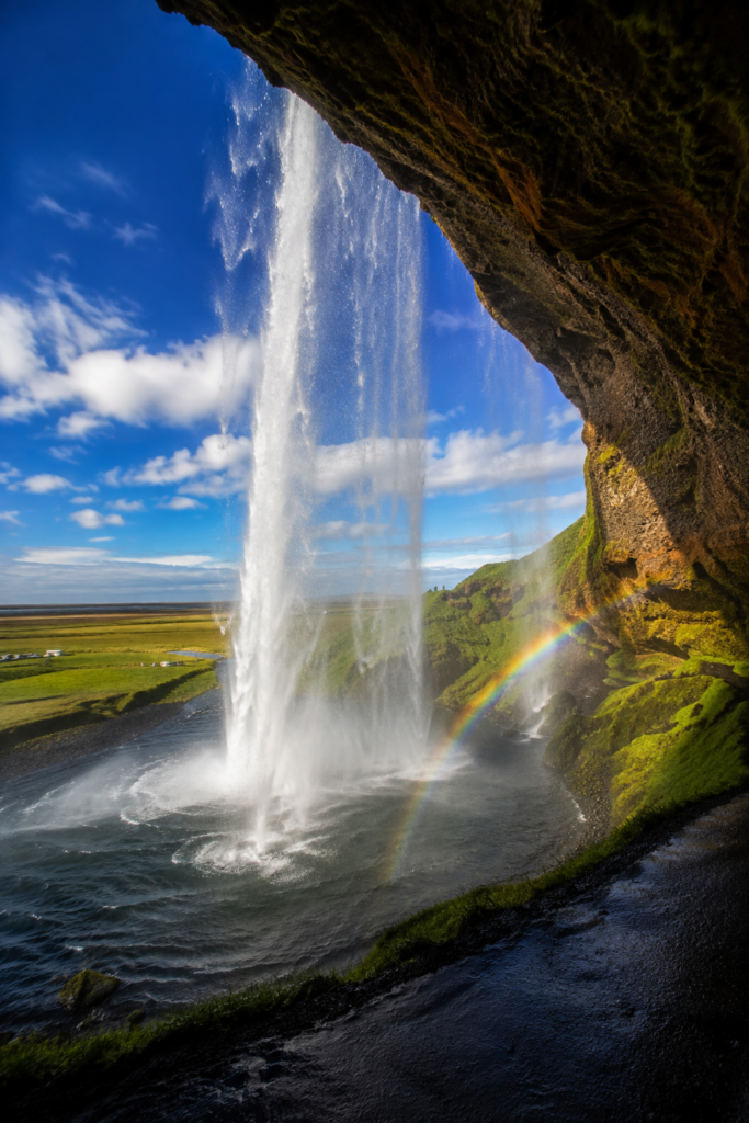
Seljalandsfoss drops 60 meters off an old sea cliff, and a paved path circles all the way behind the curtain of water. Pack a rain jacket or a dry bag for your phone. The spray reaches the path long before you reach the falls, and the rock underfoot turns slick within a few steps. A ten-minute walk north along the cliff base brings you to Gljufrabui, a smaller waterfall tucked inside a narrow canyon that most day-trippers miss.
Skógafoss
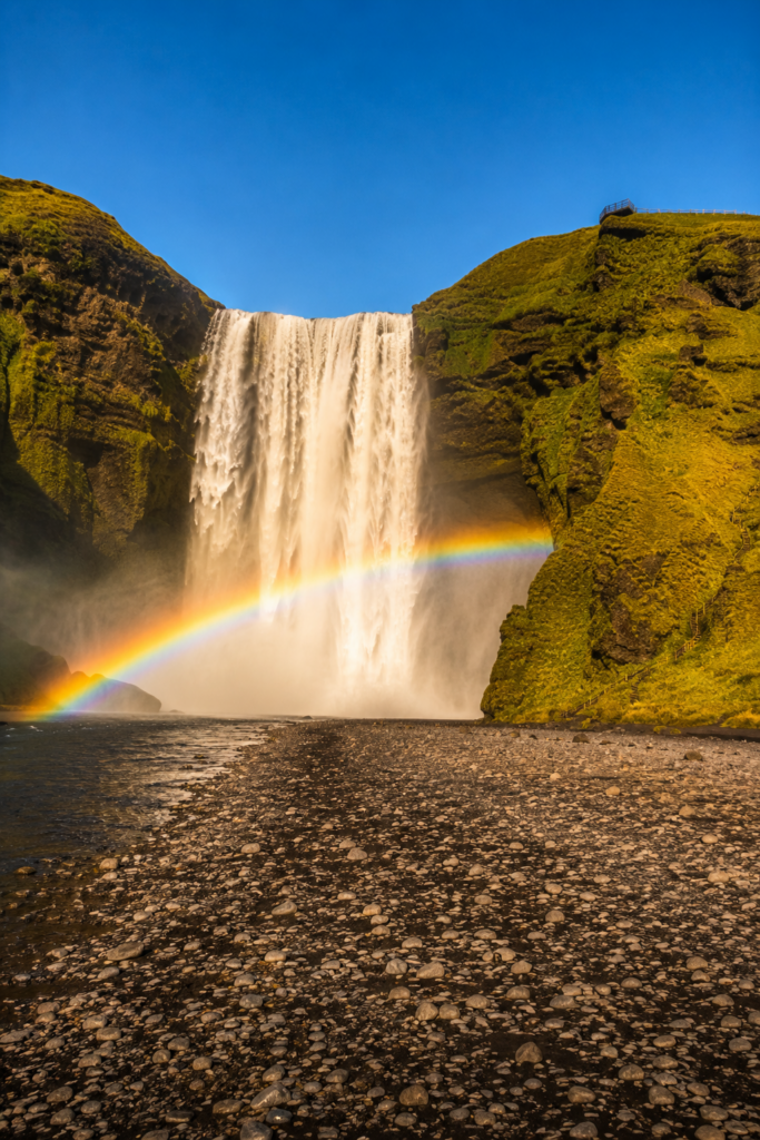
Skogafoss drops 60 meters in a single wide sheet, one of the most powerful falls on the whole South Coast. Local legend holds that a Viking settler buried a treasure chest in a cave behind the falls, and on a clear morning the spray throws a full rainbow across the pool below. A staircase of more than 400 steps climbs the cliff beside the falls to a viewing platform, and the start of the Fimmvorduhals hiking trail begins from the top.
Reynisfjara Black Sand Beach
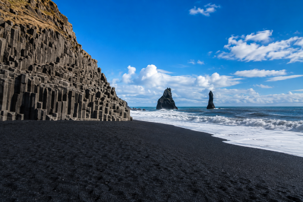
Reynisfjara is Iceland’s most photographed black sand beach, and one of its most dangerous. Basalt columns rise in hexagonal stacks along the cliff, the Halsanefshellir cave cuts into the rock behind them, and the Reynisdrangar sea stacks stand offshore, said in folklore to be trolls caught by sunrise and turned to stone.
None of that is the reason to be careful here. Sneaker waves are the reason. These waves surge dozens of feet farther up the sand than the wave before them, without warning, and the pullback carries the same force. Stay at least 30 meters back from the waterline, never turn your back to the ocean, and check the light system at the beach entrance before you walk down: green means normal caution, yellow and red mean stay well back from both the water and the cliffs. Conditions can close sections of the beach with little notice, so check SafeTravel.is before you visit. Parking costs roughly 1,000 ISK through the Parka app.
Vík í Mýrdal
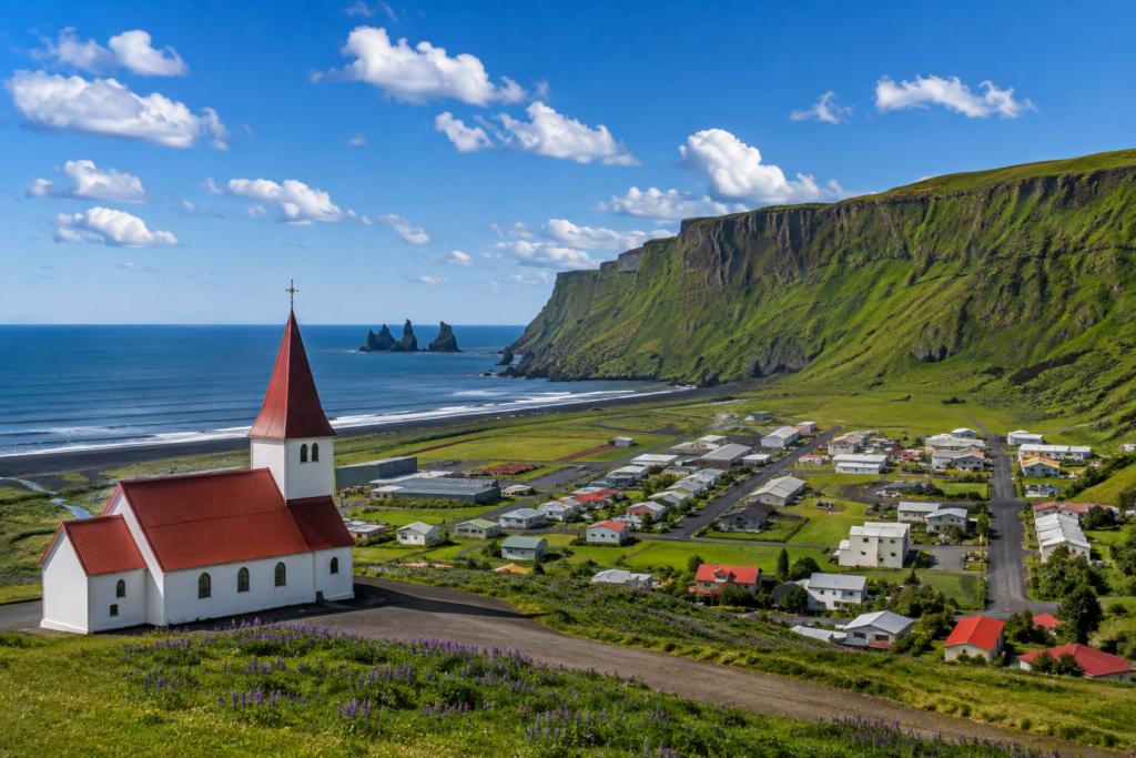
Vik marks the turnaround point for the core loop, a village of around 300 people wrapped around a black sand shoreline near Iceland’s southernmost point. Reyniskirkja, the small red-roofed church on the hill above town, gives the best wide view back over the village and the sea stacks beyond. Vik has the last reliable fuel, food, and restrooms before you either turn back toward Reykjavik or continue east toward the stops below.
Widen the Loop: Three Stops Worth the Detour
The Golden Circle widens with Kerid, Fridheimar, Secret Lagoon, and Faxi. The South Coast loop widens the same way, with three stops that stay inside a single long day without pushing all the way to Jokulsarlon.
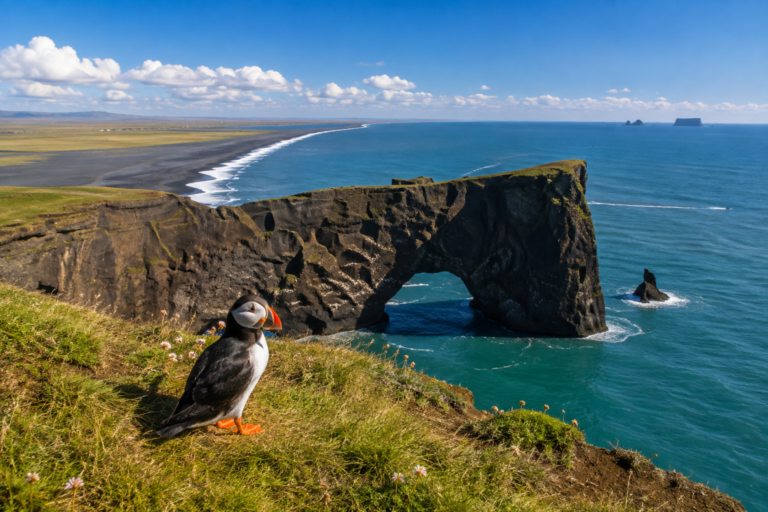 Dyrholaey’s sea arch, with a puffin on the clifftop grass during nesting season.
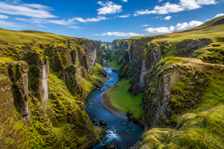 Fjadrargljufur canyon, viewed from the rim trail above the winding river.
Dyrholaey: A sea arch and lighthouse promontory a short detour from Vik, with views back over Reynisfjara and out to the Reynisdrangar stacks. Puffins nest on the clifftops from roughly mid-April through August, peaking in June and July. Part of the reserve closes overnight (typically 7pm-9am) from mid-May through late June to protect the nests; the lower car park near the arch stays open. The access road turns to gravel with a steep final stretch, fine for a standard rental car in summer, best avoided in winter ice.
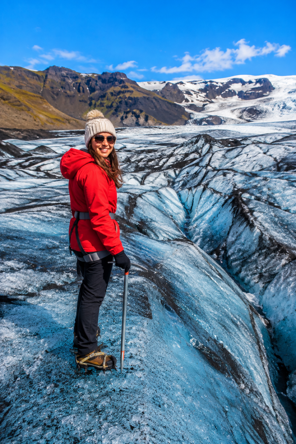
Solheimajokull: A glacier tongue off the Myrdalsjokull ice cap, close enough to Route 1 for a short detour and a guided ice walk without adding a full extra day. Crampons and a guide are required to walk on the ice itself; several operators run two- to three-hour walks departing from the parking area.
Fjadrargljufur: A canyon carved by glacial meltwater, roughly 100 meters deep and lined with moss-covered walls that turn bright green from late spring through summer. A short marked trail along the rim gives you the classic overlook without a long hike, though the canyon floor has been closed to foot traffic in recent years to let erosion damage recover, so plan to view it from above.
Good to Know
Jokulsarlon and Diamond Beach sit another 230 km beyond Vik. Reaching them means either a 12- to 14-hour round trip from Reykjavik or an overnight stay in Vik or Hofn, so we’ve kept them out of this itinerary. Look for a dedicated Jokulsarlon guide on the site soon.
Fuel up before Vik; stations thin out east of town. Iceland’s fuel pumps run on card payment with a PIN, not chip-and-signature, so check with your card issuer before you go. Daylight runs long in summer (close to 24 hours around the solstice) and short in winter (as little as four to five hours in December), so time your departure around the season you’re visiting in.
This Vik-core loop pairs naturally with the rest of Iceland’s must-see clusters. Start with The Complete Guide to Iceland for an overview of the whole country, then work through the Golden Circle and the Reykjavik city guide if you haven’t already. Packing for the trip? The Iceland Packing List covers a one-bag capsule for every season. Guides to Snaefellsnes, the Westfjords, and Jokulsarlon are coming soon.